How do tornadoes form?
A thunderstorm’s strong updraft tips spinning air—created by winds that change with height—upright.
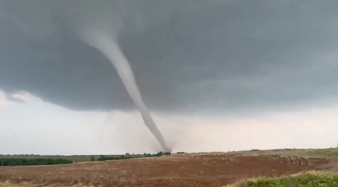
A tornado is a violently rotating column of air that reaches down from a cumulonimbus cloud to the ground. Though small—typically tens to hundreds of meters wide—it can contain ferocious winds, sometimes exceeding several tens of meters per second.
Air does not simply start spinning on its own. For a tornado to form, several conditions have to line up, in the right order. Let’s take a look behind the scenes.
The ingredients: unstable air and clashing winds
A tornado’s parent is a well-developed cumulonimbus, or thunderstorm cloud. When warm, moist air lies near the ground and cold air sits aloft, the warm air, being lighter, rises vigorously and builds a towering cumulonimbus. Meteorologists call this condition an “unstable atmosphere.”
The other ingredient is a mismatch in the winds known as vertical wind shear. This is when the wind’s direction or strength changes greatly with height—for example, a light southeasterly breeze near the ground and a strong westerly wind high above.
When the wind speed differs above and below, the air in between starts to roll like a pencil rolled between your palms, forming a horizontal tube of spinning air. At this stage, the axis of rotation is still parallel to the ground.
Horizontal spin stands up
This is where the thunderstorm comes in. When its strong updraft lifts this sideways roll of spinning air from below, the axis of rotation is tipped upright, and the roll becomes a vertical vortex.
A thunderstorm whose updraft itself has begun to rotate slowly in this way is called a supercell. The rotating updraft at its heart, a few kilometers across, is called a mesocyclone. Supercells are long-lived, and most strong tornadoes are born from this type of storm.
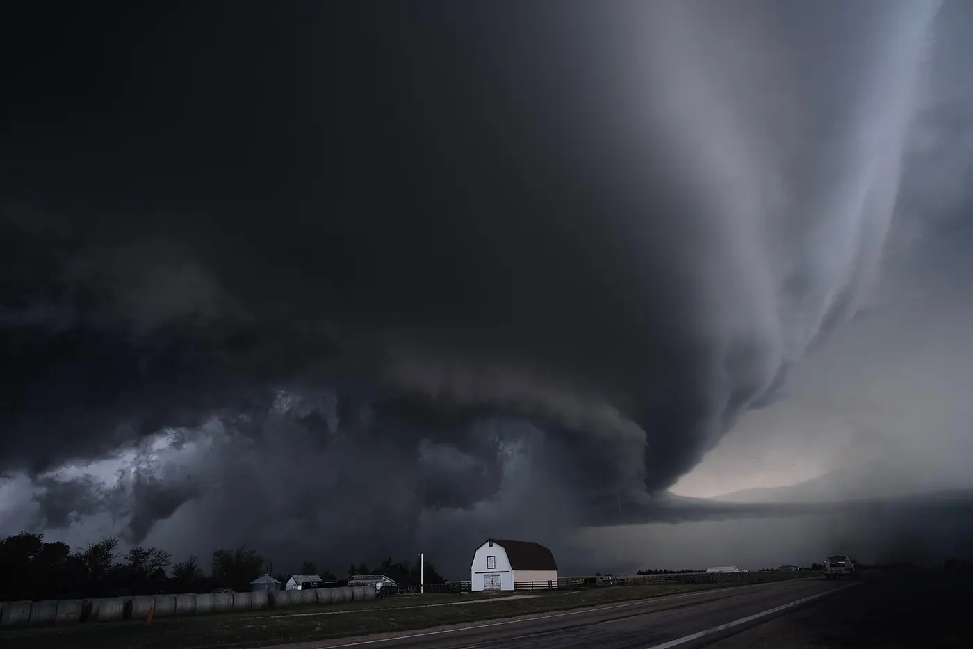

Beneath the mesocyclone, rain, cold downdrafts and other factors interact, and the rotation is drawn tighter and narrower. When it finally reaches the ground, a tornado is born. Just as a figure skater spins faster by pulling in their arms, a vortex spins faster the narrower it gets.
Having a supercell does not guarantee a tornado, however. Only some of them actually produce one. Why some storms spawn tornadoes and others do not remains one of the big mysteries researchers are still working on.
Tornado-rich America, and tornadoes in Japan
The country with the most tornadoes in the world is the United States, with about 1,200 a year. They are especially common in the region of the central Great Plains known as Tornado Alley.
In the United States, warm, moist air flowing in from the Gulf of Mexico, dry air coming from the direction of the Rocky Mountains, and cold air from Canada collide. What’s more, North America has no major mountain range running east to west, so air masses of very different character from north and south meet easily. It is an ideal stage for gathering the ingredients of a tornado.
Tornadoes are not rare in Japan either. According to Japan Meteorological Agency statistics, an average of about 20 to 25 tornadoes are confirmed each year, even leaving out those that form over the sea. They often occur with the thunderstorms that accompany typhoons, with well-developed low-pressure systems, or near weather fronts, and they are noticeably common in coastal areas.

A yardstick born in Japan
The scale most widely used around the world to rate tornado strength has been the Fujita scale. It was devised by Tetsuya Fujita, a meteorologist from Fukuoka Prefecture who made his career at the University of Chicago. In 1971, he came up with a method for estimating a tornado’s wind speed from the damage it did to buildings and other structures, and his work earned him the nickname “Mr. Tornado.”
Since April 2016, the Japan Meteorological Agency has used the Japanese Enhanced Fujita (JEF) scale, which adapts this approach to Japan’s buildings and environment. It has six levels, from JEF0 to JEF5, and ratings are based on about 30 types of damage indicators, such as houses, utility poles and trees. A tornado that struck Makinohara and nearby areas in Shizuoka Prefecture in September 2025 was estimated to have winds of about 75 meters per second (170 mph), rated JEF3, and described as among the strongest ever recorded in Japan.
Tornadoes remain hard to forecast precisely. When weather conditions make tornadoes likely, the Japan Meteorological Agency issues a “tornado alert.” If the sky suddenly darkens, a cold wind blows, or you hear a roaring sound, the basic way to stay safe is to get inside a sturdy building and stay away from windows.