When did Mount Fuji form?
Volcanoes have piled up there for hundreds of thousands of years; today’s cone took shape over about 10,000.
1707
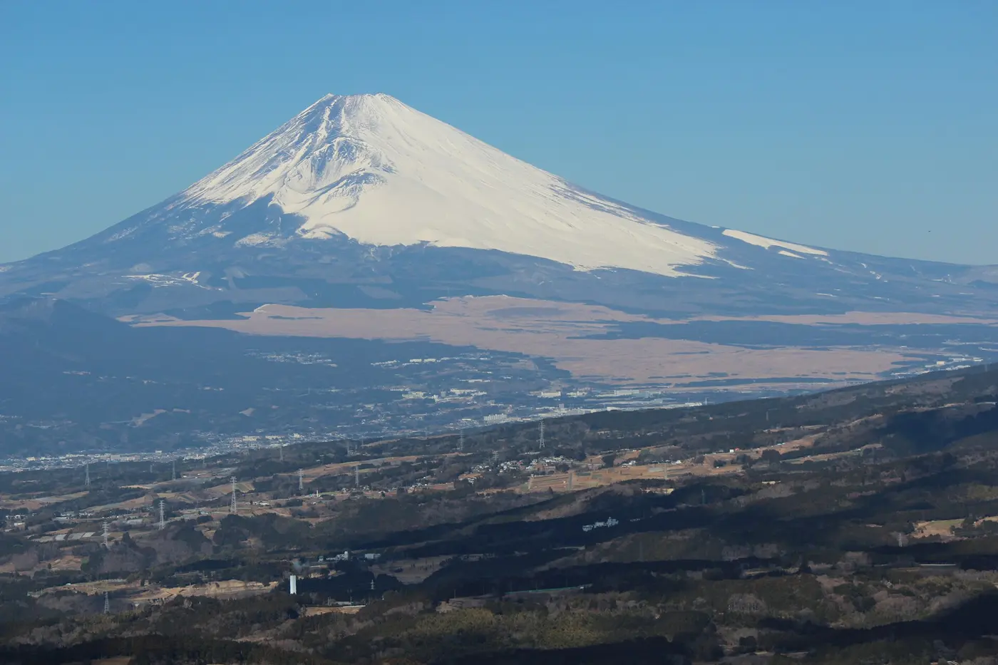
Catch sight of Mount Fuji on a clear day, from a bullet-train window or the top of a Tokyo building, and you feel a little lucky. At 3,776 meters (12,388 feet), with its gentle lower slopes spreading out on either side of a symmetrical cone, it is one of the defining views of Japan.
Yet the mountain hasn’t always stood there in this shape. Fuji is still an active volcano, and over a very long time it has changed its form with each eruption. Inside it, what’s more, several older volcanoes are stacked on top of one another, like the floors of a building.
A four-story volcano
Mount Fuji’s structure is often likened to a four-story building.
The bottom floor is the Sen-Komitake volcano. It can’t be seen from the surface. It was discovered in 2004, when a borehole drilled by the University of Tokyo’s Earthquake Research Institute found it buried beneath Mount Fuji. It is thought to have been active several hundred thousand years ago.
The second floor is the Komitake volcano, which is believed to have gone quiet by about 100,000 years ago. Its summit just peeks out on the north flank of today’s Fuji. The area around Komitake Shrine, at the Fifth Station at the end of the Fuji Subaru Line road (about 2,300 meters up), is thought to be the old summit of the Komitake volcano. In other words, that busy Fifth Station, crowded with tourists, sits on the peak of an “earlier Mount Fuji.”
The third floor is the Old Fuji volcano, or Ko-Fuji. About 100,000 years ago, eruptions began on the southern slope of Komitake, and repeated explosive blasts of ash and cinders built up a large mountain. Ash thrown out by Old Fuji drifted on the westerly winds and settled across the southern Kantō region around Tokyo, where it now forms part of the region’s red soil, the Kantō loam.
And the top floor—the mountain we see today—is the New Fuji volcano, or Shin-Fuji. Starting about 11,000 years ago, eruptions that poured out huge volumes of lava became common, and the new cone grew until it had buried Old Fuji completely. Estimates of each volcano’s age vary from study to study, and new research continues to revise them.

Where three plates meet
Fuji’s great size is thought to have something to do with its location. The ground almost directly beneath it is where the boundaries of three tectonic plates meet: the Philippine Sea Plate, the Eurasian Plate (Amur Plate) and the North American Plate (Okhotsk Plate). One proposal is that magma has been welling up in large amounts for a very long time through a tear in the sinking plate.
Mount Fuji has a volume of more than 400 cubic kilometers, making it the largest basaltic stratovolcano in Japan. Basalt lava is runny and flows easily. As lava pouring from the summit and flanks spread out in every direction and piled up layer upon layer, it shaped those beautiful sweeping slopes.
The last eruption, in 1707
Written records note at least ten eruptions of Mount Fuji since the 8th century. In the Jōgan eruption of 864, huge amounts of lava poured from the northwestern foot of the mountain, filling in a large lake that stood there at the time and creating today’s Lake Sai and Lake Shōji. The forest that grew over that lava is Aokigahara.
The most recent recorded eruption is the Great Hōei Eruption of 1707. In October of that year, the Hōei earthquake struck a vast area stretching from the Tōkai region to Shikoku. Forty-nine days later, on December 16, an eruption began on Fuji’s southeastern slope and blasted out huge amounts of pumice and ash for about two weeks.
Carried on the westerly winds, the ash fell on Edo (present-day Tokyo), about 100 kilometers away. The scholar Arai Hakuseki wrote that white ash fell like snow and that it grew dark even in the daytime. In villages at the foot of the mountain, fields were buried under thick sand so that crops could no longer grow, and recovery took many years.
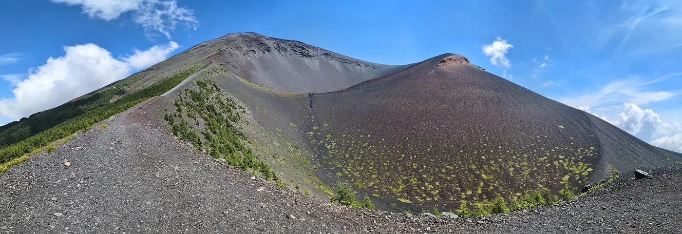

The crater left by that eruption, along with the bulge beside it known as Mount Hōei, still scars the southeastern slope today. Seen from around the cities of Fuji and Fujinomiya in Shizuoka Prefecture, it is the hollow on the mountain’s right shoulder.
It has been a little over 300 years since the Great Hōei Eruption, and Fuji has not erupted since. Even so, it remains one of the active volcanoes that the Japan Meteorological Agency monitors around the clock.