What is the largest island in the world?
Greenland, at about 2.16 million square kilometers—roughly 5.7 times the size of Japan.
2.16 millionkm²
What is the largest island in the world? The answer is Greenland, which sprawls across the Arctic. Some people may tilt their heads at that, though. Look at a map, after all, and Australia is far bigger.
In fact, “the world’s largest island” rests on a human convention: where we draw the line between an island and a continent. Following that line also reveals an unexpected pitfall in the way maps make things look.
A giant island locked in ice
Greenland lies northeast of the North American continent, between the Arctic Ocean and the Atlantic. Including the small islands around it, it covers about 2.16 million square kilometers (834,000 square miles), roughly 5.7 times the land area of Japan.
Most of it is covered in white ice. The ice sheet that blankets about 80 percent of the island is more than 3,000 meters thick in places, and the interior is a world of ice as far as the eye can see. People live only on narrow strips of ice-free land along the coast, and the population is under 60,000. Politically, Greenland is part of the Kingdom of Denmark, but it is a region with broad self-government, and its capital is Nuuk.
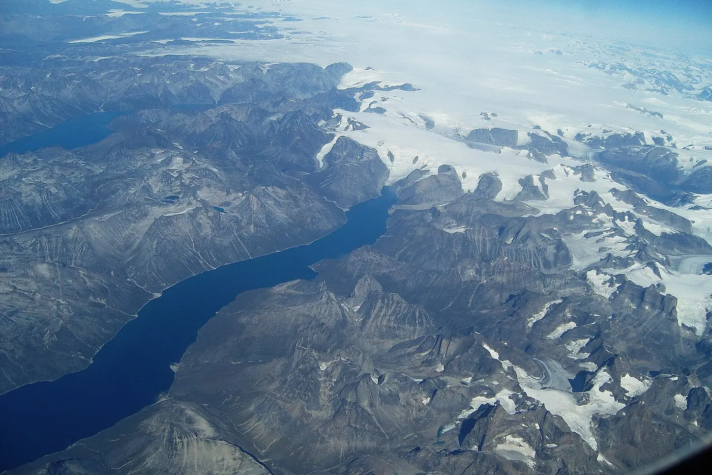

It is a little odd that an ice-bound island should be called “Green” land. According to old Icelandic tradition, Erik the Red, who settled there in the 10th century, chose the name because he thought a good name would draw people. It was, in effect, an advertising slogan to attract settlers.
Why isn’t Australia an island?
So what about Australia? In the sense of being entirely surrounded by sea, Australia is just like an island. Its area is about 7.69 million square kilometers, roughly 3.5 times that of Greenland.
Even so, Australia is usually treated as a continent. In fact, there is no strict, universally agreed definition that separates islands from continents. Australia is a large landmass riding on a plate separate from the other continents, cut off from them over a long history and home to its own unique wildlife. Partly for reasons like these, it is conventionally counted as a continent.
Greenland, on the other hand, sits geologically on the same plate as North America and is regarded as an “island”: part of a continent separated by sea. In other words, the boundary between island and continent is drawn between Australia, the “smallest continent,” and Greenland, the “largest island.”
Maps make it look bigger
Incidentally, on the kind of world map that hangs in school classrooms, Greenland is drawn so large that it invites comparison with Africa. This is a feature of the Mercator projection.
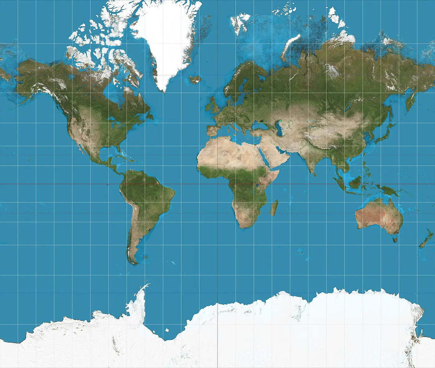

Because it shows angles correctly, the Mercator projection has long been widely used as a convenient map for navigation. But to stretch the round Earth onto a flat sheet, it draws land larger than it really is the farther you go from the equator toward the poles. Greenland, far to the north, takes the full brunt of this effect. In reality, Africa covers about 30 million square kilometers, about 14 times the area of Greenland.
The runners-up, and Honshu in seventh place
After Greenland, the world’s largest islands are New Guinea in second place, Borneo in third and Madagascar in fourth. New Guinea and Borneo each exceed 700,000 square kilometers, and Borneo is shared by three countries: Indonesia, Malaysia and Brunei.
Japan’s main island, Honshu, covers about 228,000 square kilometers, making it the seventh-largest island in the world. It is slightly larger than Great Britain, which shows that the heart of the Japanese archipelago is a sizable island even by world standards.