What is the oldest map in the world?
The oldest “world” map is said to be a 2,600-year-old Babylonian tablet. For maps in general, accounts differ.
We live in an age when, just by opening a smartphone, you can instantly see a bird’s-eye map of any place on Earth. Yet if you think about it, a map is a curious tool. Long before anyone could fly, people pictured the land from directly above in their minds and copied it onto a flat surface.
So which is the oldest surviving map in the world? As it happens, the answer depends on what you mean by “map.”
A “world map” that fits in your hand
The oldest known map that tries to show the whole “world” is the Babylonian Map of the World, held at the British Museum in London. It is a clay tablet found at Sippar, an ancient city in what is now southern Iraq, and is thought to date from around the sixth century BCE, about 2,600 years ago. Some have pointed out that the image it was based on may go back even further.
It is only about 12 centimeters (5 inches) tall and fits neatly in the palm of your hand. On its surface, alongside text in cuneiform script, are carved several circles and lines.
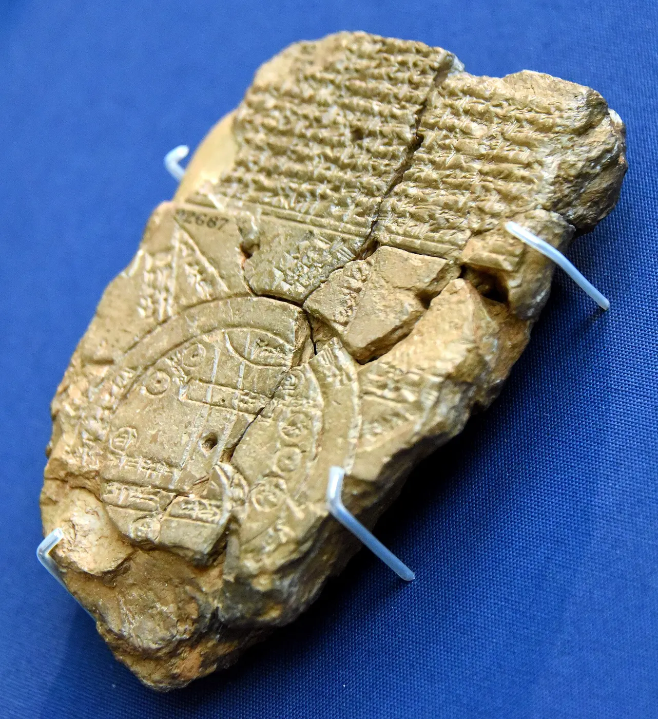

The rectangle near the center is thought to be the city of Babylon, and the line running vertically through it the Euphrates River. Around it are placed lands such as Assyria, and a large circle surrounds everything. This circle is the “Bitter River”—the ocean, which was believed to flow around the land.
Where the world ends, myth begins
The most intriguing part of this map lies beyond the ocean. Several triangles jut out from the outer circle, and the text on the tablet describes them as places such as a land where the sun is never seen, or distant regions not even birds can reach.
In other words, this map was not made to record accurate distances or directions. It put the makers’ own city at the center, arranged the countries they knew around it, and imagined a world of myth and legend beyond that. It was a direct expression of the worldview held by the people of ancient Babylonia.
Older contenders
If we count maps of particular regions or towns, however, there are older examples.
Many maps drawn on clay tablets have been found in Mesopotamia. A tablet unearthed at the site of Nuzi in northern Iraq is said by some to date from around 2300 BCE, and it shows what appear to be rivers, mountains and settlements. Excavations at the ancient city of Nippur have also turned up a town plan on a clay tablet from around 1500 to 1300 BCE. Because it shows city walls, gates and temples, it is regarded as one of the oldest city maps.
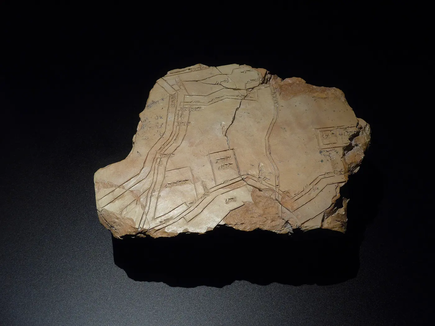

Go back further still, and the candidates become far less certain. At Çatalhöyük, a Neolithic site in Turkey, a wall painting more than 8,000 years old was once thought to be a “map” showing rows of houses and an erupting volcano. Others have countered that it actually depicts the spotted pattern of a leopard skin, and the debate remains unresolved. In France in 2021, a study claiming that a Bronze Age stone slab about 4,000 years old was the oldest map in Europe made headlines.
What counts as a map?
Deciding whether a mural or lines carved into rock are a map is extremely difficult. With the people who made them long gone, there is no way to know for certain whether they represent land, a decorative pattern or something else entirely.
Searching for the oldest map also means deciding where a “map” begins.
What is certain is that from the time writing had barely been invented, people have tried to draw the land they lived on and the world that stretched beyond it.